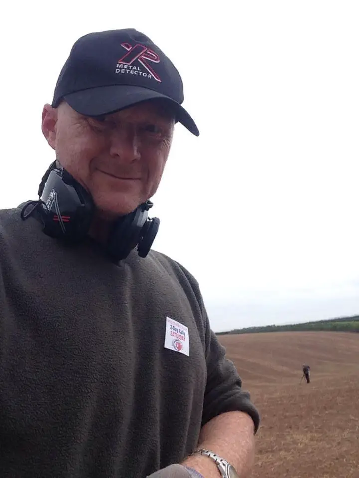
Metal detecting research
Carrying out historical research on potential search sites can boost your finds rate and be one of the most interesting pastimes. We give you 7 information rich resources to carry out metal detecting research.
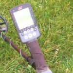
As a newcomer to metal detecting, I was just eager to grab my metal detector and get out there in the hope of finding something interesting.
That is the fun element but as time goes on and your interest in the hobby grows, a natural interest in historical things does also. (Read my article about how to select a good beginner metal detector)
As well as desperately trying to remember monarchs and what their heads look like on coinage, along with their periods of reign, you’ll find that you get pulled into carrying out research.
As well as research being extremely interesting, it can also improve your finds rate.
By that, I mean instead of finding “casual” losses in a field, you may be able to find more concentrated losses along medieval long lost footpaths or around buildings that are long gone but shown on a old map.
Does that sound interesting? Finding land to detect on can be tough but I have an article on how to help find a farmer who will allow metal detecting here.
How about going as far as being able to see the footprints of roman buildings beneath the visible ground with LIDAR mapping or being able to log into a database and find historical data where you have permission.
You can even find out what items have been found and logged.
How to research for treasure hunting and metal detecting
There are various incredible sources of information that are available at your fingertips. These are 8 of the best and are the ones I use regularly when I get permissions for new land.
The first thing I do is to make sure I have map with me when I see the landowner. With his help, I then mark a line around the land he owns.
The last thing you want to do is wander onto a neighbouring farmers land because that’ll land you in some very hot water!
Once I’ve done that, I’ll spend a quiet day on the computer with a cup of coffee and a notepad and map marking anything of interest.
These could be old buildings, converging footpaths, places of worship etc. Old footpaths can be a great source finds. When you think of how many people have used them over the years.
One trick I use is to find a footpath on an Ordnance Survey map and then try to find it on a old map. (There is an easier way now which I’ll show you in a minute!)

Ultimate Tactical Packs!
Carry everything you’ll need for a detecting day like a First Aid kit, detector spares, finds boxes, batteries, snacks and drinks to rehydrate.
Never forget anything again with a belt pack!
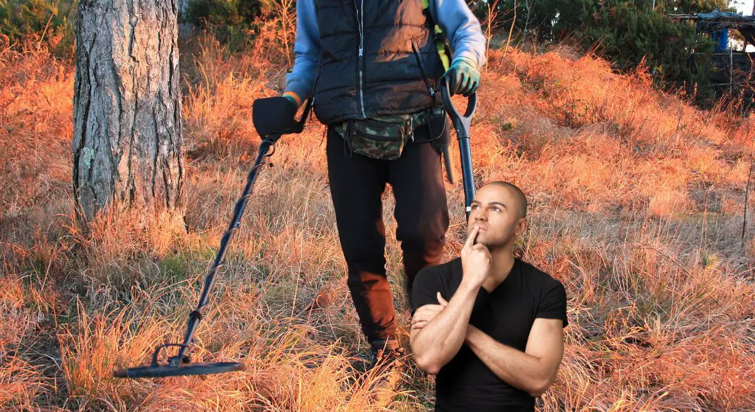
Where to go metal detecting?
So, where to go metal detecting?…..it’s an interesting question and the answer is “anywhere you have permission for”. (Take a quick look at my article on metal detecting and the law)
There is another way to approach this also. (and I’ve done this many times!) You can carry out lots of research around where you live first.
Gather lots of information and if you see something really interesting, make a note of where it is and THEN approach the farmer or landowner.
You could even talk about how you’ve carried out the research on the land and how interesting it could be. Try and get them to buy into it.
Metal detecting for beginners UK
So where do you start to research metal detecting for beginners in the UK? Well luckily, I’m here to help you and I don’t mind at all. That was the main reason for starting this blog!
I want new detectorists to come into the hobby, promise to be responsible so it doesn’t ruin it others and share the excitement of finding that special item!
Here are the 8 most useful resources to gather as much historical data to improve your finds and maximise your time.
A top tip is to explore an links I have given you and to bookmark them so they are easier to find again. I have an article on metal apps that also give you some great resources here.
7 Essential metal detecting resources
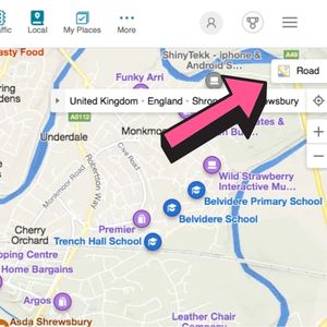
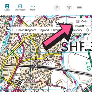
Bing Maps (Free)
Unless you’ve been living on a desert island, most people will be familiar with Google Maps.
Because most people naturally default to Google, they forget that Microsoft has an alternative OS mapping system that hardly anyone seems to be aware of.
The OS mapping (to 1:25000) in the UK is free on Bing Maps!
In the drop down box in the top right corner, Ordnance Survey is the fifth one down and can be easy to miss. Ordnance Survey also has an online version of its well known paper maps.
This is unfortunately now a subscription only service so if you would like to use OS maps online for free, the best alternative is Bing, from Microsoft but ……shhhhhhh!……keep it quiet! Get Bing Maps here!
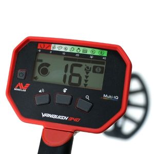
Unbeatable Multi Frequency!
You can now get the ultimate power of multi frequency technology over single frequency detectors with the Minelab Vanquish range of detectors.
The entry level Vanquish 340 now gives you ultimate depth, stability and sensitivity on all target types in every soil, including wet beach sand.
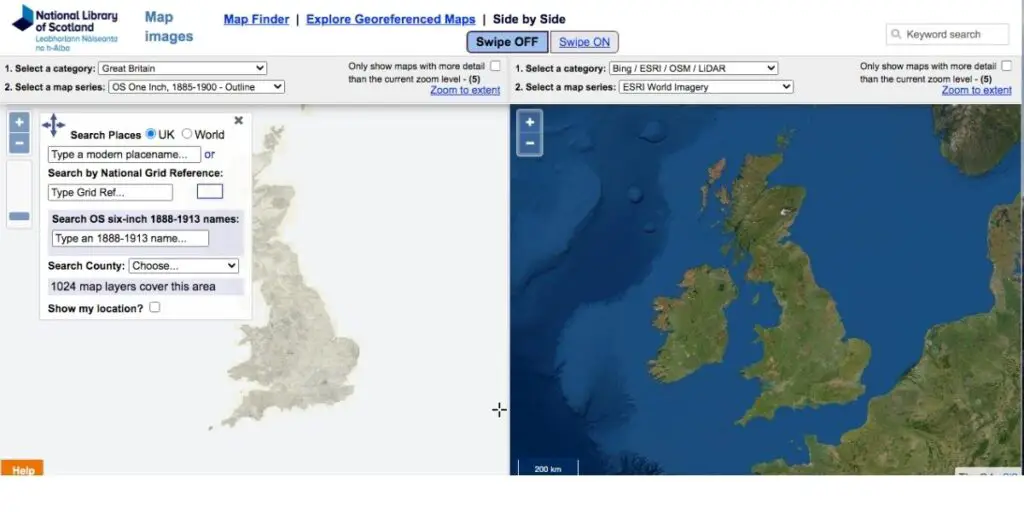
Side by Side geo-referenced maps (free)
This resource is one of my favourite pieces of software to uses because it’s so clever.
The National Library of Scotland have basically digitised a massive amount of old maps, including town plans, estate maps, and military maps and then cleverly mapped them next to a modern map.
Don’t worry, just because the mapping has been resourced by the National Library of Scotland, the maps cover the UK!
When the cursor or cross hairs are moved, the location is matched on both maps so it makes it really easy track footpaths for example. I then take a screen shot and print it out and mark the footpath on the modern map.
The really clever thing with this resource is that you can easily zoom in and out and the content box on the left hand side allows you to input a location via a name or a grid reference if you have it.
You can also change through the old map choices to see how far back a particular feature has been there for.
For example, a footpath may have been indicated for 200 years on old maps but then disappear on a new map!
Just remember to click the “Show Search Panel” box on the top left to open up the search box. You can access Side by Side maps from the National Library of Scotland here.
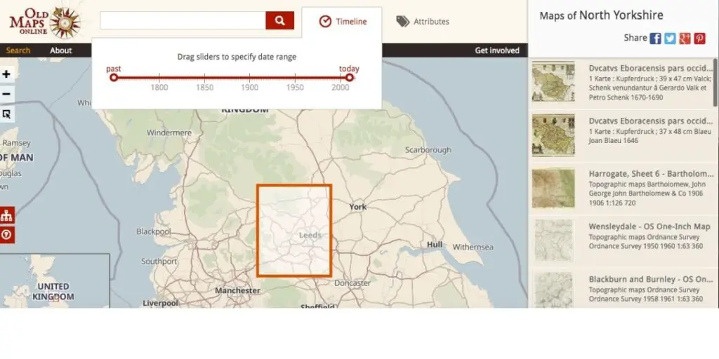
Old Maps Online (free)
This is another favourite resource of mine and it’s free! The interface is little tricky to use but okay once you get used to moving the map around rather than moving the highlighted square around.
This valuable resource allows you to view old maps going back through various years.
You can narrow down areas by inputting search locations. It also has a really neat timeline feature that allows you to use a slider to change the timeframe.
There are many old maps to choose from on the right hand side. You can access Old Maps Online here.

The Evolution Pro Cut
The ultimate accessary for the serious metal detectorist. Super strong, stainless steel specially designed spade.
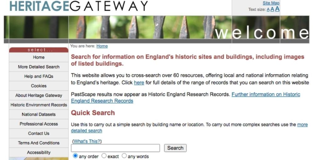
Heritage Gateway (free)
Heritage Gateway when I first started out used to be known as “Pastscape” but I think it’s had a revamp. This is another free resource that I regularly use.
The interface is a little busy and it takes a little while to find your way around but it is a powerful resource and it’s free!
It links and draws from several databases and with the drop down boxes, you can fine tune your search criteria.
In fact, the Heritage Gateway website allows you to cross search over 60 resources from local and national information relating to England’s heritage.
Options include a quick search and a more detailed search using location names or grid references. You can access the Heritage Gateway here.
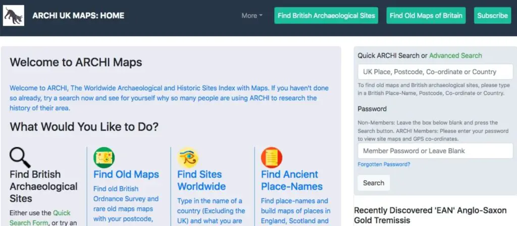
ArchiUK (subscription)
The ArchiUK website is a subscription service but it is well worth it. It is available as a monthly subscription so if you wish to carry out a small amount of research, ArchiUK gives you the flexibility to do so at a low cost.
To maximise your research however, the annual subscription is very reasonable and infinitely more cost effective. You also have it to hand whenever you acquire new permissions.
ArchiUK is basically your one stop shop for detectorists. If you are going to go for a subscription service, this is the one to go for. It is a database of over 200,000 historical sites and finds locations with 10,000 entry updates every year.
By using ArchiUK, you can find out what has been found in your local area and where.
By taking out a subscription, your search results will be enhanced with a distribution map of all the sites from your search.
This has been designed to enable you to quickly see the most interesting archaeological zones in your areas of interest.
Further, the GPS co-ordinates of the sites shown from your search plus aerial photographs and modern road maps showing the position of the site on the ground are given.
You will also be able to view the location of the site on older maps (19th Century, mid-20th century) – invaluable it you want gain a deeper understanding of the historical landscape in the area of the site.
The precise locations (as GPS co-ordinates and marked on maps) of tens of thousands of Prehistoric, Roman, Iron Age / Celtic sites, Bronze Age, Saxon and Medieval sites and later sites are listed in the UK database.
Plus there are links to road maps and aerial photographs showing the location of the sites on the ground.
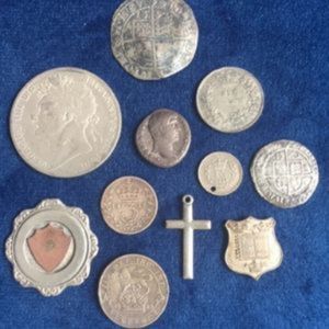
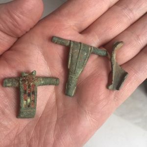
Many beautiful and historically significant coins & artefacts and previously unknown ancient sites have already been found and reported by field walkers and metal detectorists who have used the ArchiUK database for their research.
This could be the only resource you need!
Go over to the ArchiUK website and check out the latest subscription costs.
Unbeatable Multi Frequency!
You can now get the ultimate power of multi frequency technology over single frequency detectors with the Minelab Vanquish range of detectors.
The entry level Vanquish 340 now gives you ultimate depth, stability and sensitivity on all target types in every soil, including wet beach sand.
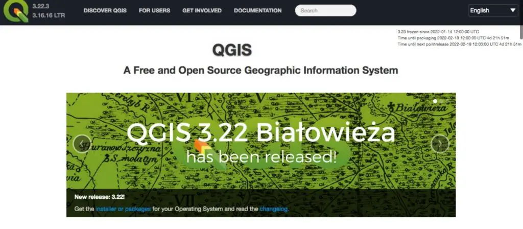
QGIS (free)
QGIS is without doubt one of the world’s leading Open source GIS software packages and it’s free!
It can even be used to process point cloud data such as LiDAR, but many people prefer to process elsewhere then import the results. It will take a little while to master but it is free so you can’t complain.
LIDAR stands for Light Detection and Ranging and is a remote sensing method that uses light in the form of a pulsed laser to measure the Earth.
These light pulses penetrate the ground and when combined with other data recorded by airborne systems generate precise, three dimensional information about the shape of the Earth and its surface characteristics.
It’s this penetrating effect that can make the impossible to see, visible. Typically, old building foundations for example.
As LIDAR maps come in a specific format, you will have download a small piece of software that will allow you to interpret these maps into something you can see. Don’t worry, this software is also free.
You can get to the QGIS website by clicking here.
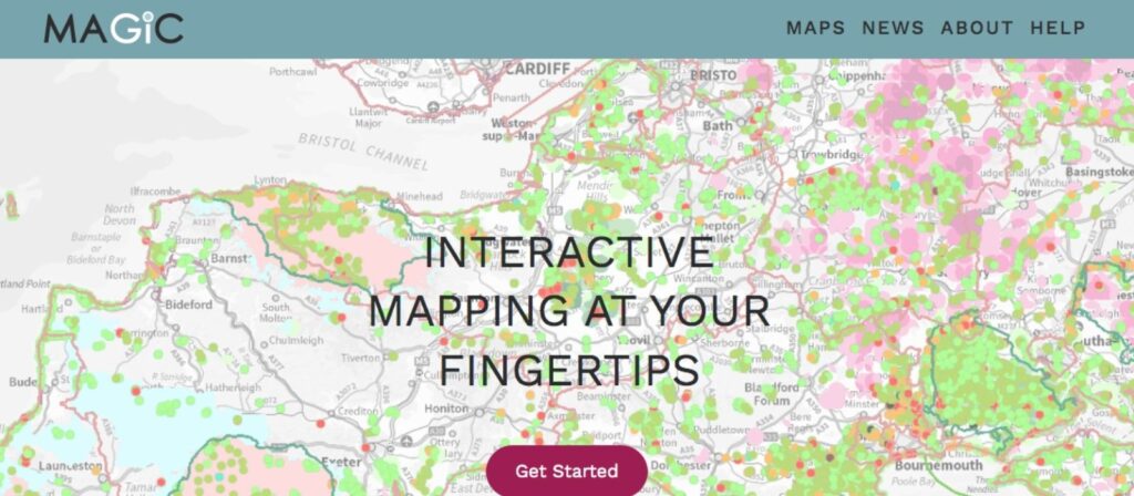
Magic (free)
The MAGIC website is a very important resource and provides authoritative geographic information about the natural environment from across government.
The information covers rural, urban, coastal and marine environments across Great Britain.
It is presented in an interactive map which can be explored using various mapping tools that are included.
Natural England manages the service under the direction of a Steering Group who represent the MAGIC partnership organisations.
If you are worried about wandering onto a protected area, the MAGIC website will tell where you can detect and where you most definitely can’t.
You can find the MAGIC website by clicking here.
Final thoughts
Okay, so we’ve covered quite a bit in this article.
By carrying out even the smallest amount of local research, you can really up your finds rate by concentrating in areas that have seen more traffic over the years. Many of the resources I have put forward are free which is great.
The ArchiUK which is the only paid subscription resource is absolutely fantastic also.
Armed with these resources, you can now check your permissions for old buildings, footpaths or religious monuments.
You can get into the mindset of people from medieval times who lived in a small village and forged a footpath through some fields to get the local church.
How many times were personal items and money lost on this footpath?
You will have access to resources that will tell you what has been found and where. You’ll have access to technology that sees into the ground making visible buildings that were never seen before.
The possibilities are endless! I hope this article has been of use….good luck and happy hunting!
Unbeatable Multi Frequency!
You can now get the ultimate power of multi frequency technology over single frequency detectors with the Minelab Vanquish range of detectors.
The entry level Vanquish 340 now gives you ultimate depth, stability and sensitivity on all target types in every soil, including wet beach sand.